Start a survey and obtaining RTK float/fix
1. Ensure the GNSS device in the locator has access to GNSS satellites
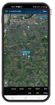
2. Select ‘NEW’ from the top right-hand corner of the app.
3. Select a utility type
4. You will now see a box of information in the top righthand corner of the screen. If after 10-15 seconds
‘Diff source’ does not appear then you may need to toggle the ‘GPS’ button near the bottom of the screen.
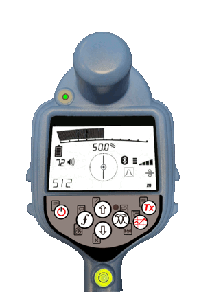
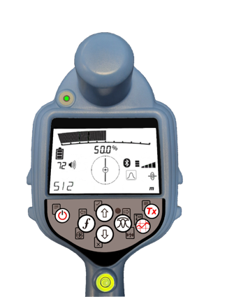
5. The ‘Fix type’ field will display values such as GPS, DGPS, RTK float and RTK. The LED on the locator notifies you of RTK float (flashing) and RTK fix (solid).
 |
 |
RTK float (flashing)
|
RTK fix (solid)
|
6. The time to first fix will be longer as the GNSS device is performing a cold start. Find an area that
has good visibility of the sky and stand still. This may take up to 15 minutes for the first fix, but will be
much quicker for subsequent uses.
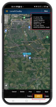
Once RTK float/fix has been achieved you can start the survey. If the Survey Measurements log interface is set up correctly, you’ll see it described as ‘ready’ in the information box.
8. Take Survey Measurement readings by pressing the Survey Measurement button at set intervals or when required. The point should appear in the PointMan app a few seconds later.
9. The RD8200SG is fitted with a level/bubble for ultimate precision. When taking a survey measurement reading, the RD8200SG automatically compensates for the difference between the GNSS antenna position and the foot of the locator. Keep the bubble central for ultimate positional accuracy. Use of the bubble is optional.
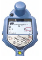 |
 |
Locator searching for satellites
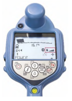
|
Locator identified satellites
|