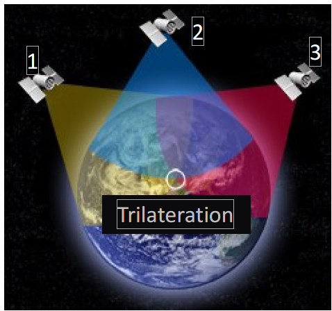
Basics: Just like pipe and cable locators don’t actually detect pipes and cables but rather EM signals, GPS receivers don’t measure “position” they measure TIME. By measuring the time it takes for a satellite signal to reach your GPS receiver, your position on Earth's surface can be determined by comparing time intervals from multiple satellites using a method called trilateration (often mistaken for triangulation).
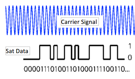
Advanced: You may ask “how does this measuring time thing work? Good question. The basic technique is that a satellite transmits a radio signal to earth similar to the land-based radio broadcasts you are familiar with (a carrier signal is modulated with information). However, the satellite carrier signal is a much higher frequency (~1.5GHz) and the modulated information is much more precise and sophisticated. The carrier signal is not important for now (but it will become so later in our RTK discussion).
The high frequency carrier signal contains encoded digital data such as Sat ID but more importantly it contains a critical piece of info related to TIME - embedded in the signal is a time stamp that contains the exact time the signal was transmitted from the satellite (with atomic clock accuracy).
|
|
Buzz words you may hear:
- C/A code (Course Acquisition)
- Pseudo Range Measurement
Don’t worry about these names, very advanced signal stuff – just know that like modern radio signals there is a CARRIER and that digital data is embedded in the carrier signal that contains time stamp info among other things.
|
UTTO - Copyright IPEG Corp 2023