You can review, measure and edit a marker at any time.
To review a marker:
- Select the marker on the map.
The map will automatically center on the marker selected. The marker will be highlighted by a star symbol and its latitude and longitude displayed.
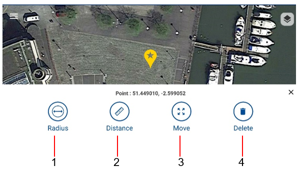
Available functions
4 functions are available when reviewing a marker:
- Radius measurement
- Distance
- Move
- Delete
To access them:
- Click on a marker you want to measure
Radius measurement
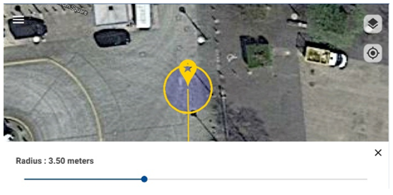
When this function is selected a circle is drawn around the marker, allowing a quick measurement of the distance between the marker position and a point on the map, such a pavement curb or lamppost
- Control the radius of the circle by moving the slider left or right
- Press X to exit this function
Distance measurement
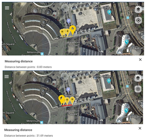
- Select a different marker to estimate the distance between from the marker selected. A red line will connect the 2 markers selected
- Press X to exit this function
Move
When you select the move function you will be able to move your marker in a different position. This is useful if your location is not accurate.
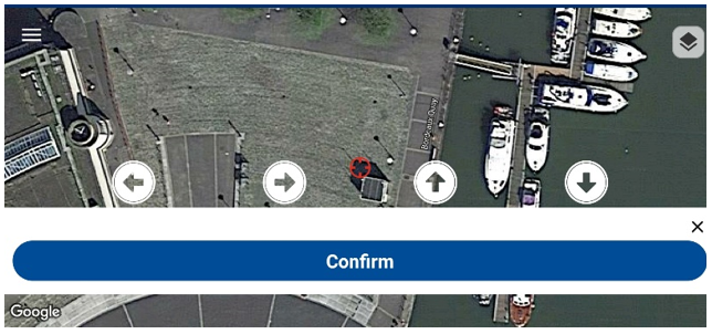
- Use the Google Maps pan, zoom and rotate functions to position the map in your preferred orientation and showing the desired level of details
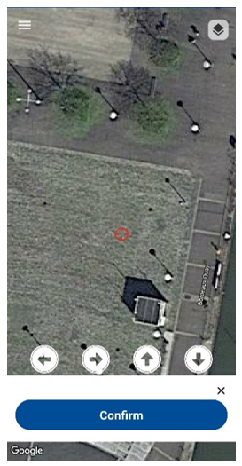
- Move the Map with your finger for course positioning
- Use the arrows keys for fineadjustments
- Press X to exit this function
- Press Confirm to move the marker
Caution: Moving a marker cannot be reversed
Deleting a marker
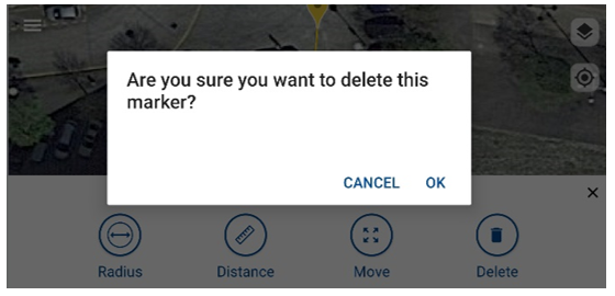
To delete the selected marker:
- Select Delete
- Press OK to confirm you want to delete the marker and all the associated locator’s measurements
or
- Press CANCEL to exit this function
 WARNING: Deleting a marker will delete this and all associated survey measurements from RD Map. This action cannot be undone.