RD Map+ allows users to use a compatible external high accuracy GNSS receiver with
Bluetooth® wireless connectivity.
Read here if you are setting up a Trimble® Catalyst™ DA2.
NOTE: You will need an RD Map+ Premium license to use an external GNSS receiver.
External GNSS receiver Connectivity requirement
Your external GNSS receiver must support NMEA 0183 over SPP Bluetooth. If unsure, please refer to the operation manual that came with it.
Setting Up RD Map+ to use an external GNSS receiver
Follow these steps to set RD Map+ to use your external GNSS receiver as your default position source when creating your utility maps.
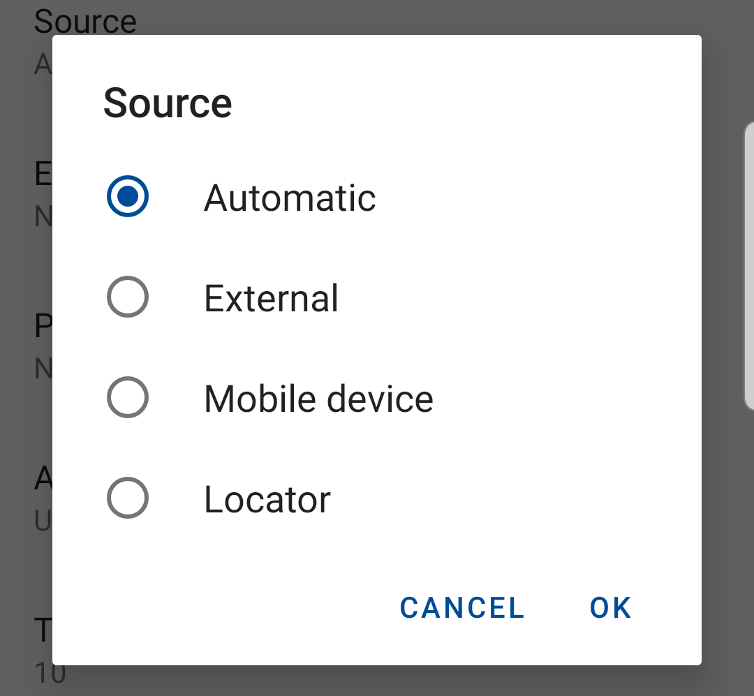
From the Position section in the settings menu:
- Set your Source
Select Automatic or External and tap OK
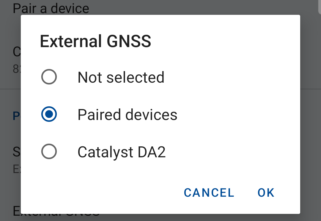
- Set External GNSS
Select Paired devices and tap OK
- Pair and select your device
If you have already paired your device just select it and tap OK
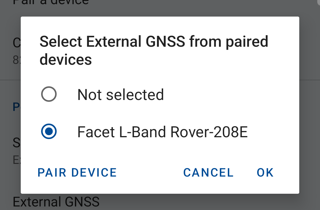
or tap Pair Device to initiate the pairing process.
NOTE: the external GNSS receiver must be on and in pairing mode
Using external GNSS receiver
If you have followed the steps above you are now ready to start using your external GNSS receiver.
Ensure your external GNSS device is turned on before you start a utility survey.
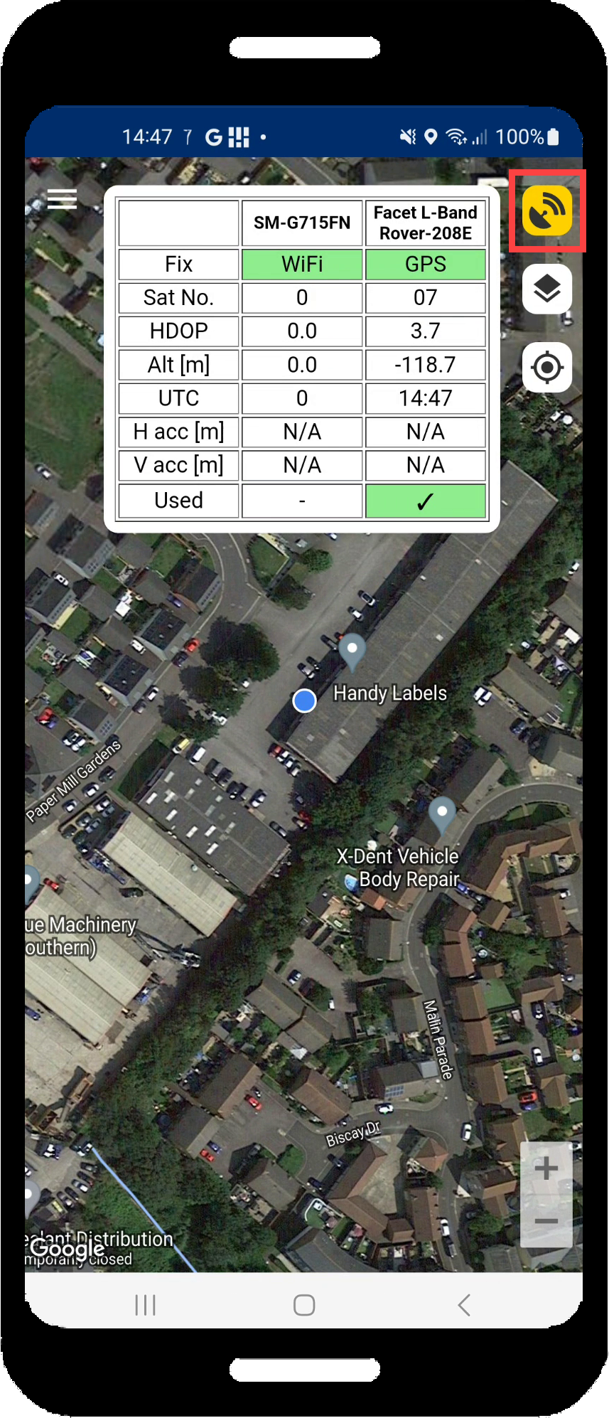
When you start a utility survey RD Map+ will display the External GNSS status screen
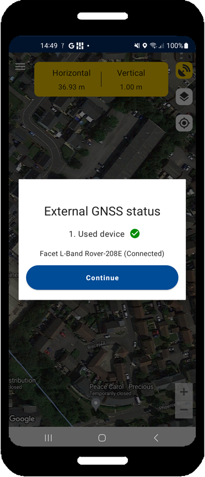
- Tap Continue to start your utility survey
- Tap the GNSS icon to check the GNSS status
Once you are ready start taking survey measurements from your locator to create a utility survey map